
FILED UNDER: CARTOGRAPHIC DIVISION
CIRCULAÇÃO RESTRITA
REF: CART-009 · FORT KAEL CARTOGRAPHIC DIVISION · YEAR 812
The Archive Districts of Fort Kael
This map represents the administrative districts of Fort Kael as surveyed in Year 812. It shows the principal zones of institutional function: the Citadel Superior, the Archive Districts, the Military Archive, the Signal Department, and the subordinate quarters. The map was produced for internal administrative use. It is marked for restricted circulation.
Several passages and chambers are not included. The note appended by the cartographic officer states that their omission is by instruction of the Commandant's office. The cartographic officer's name is not on the record.
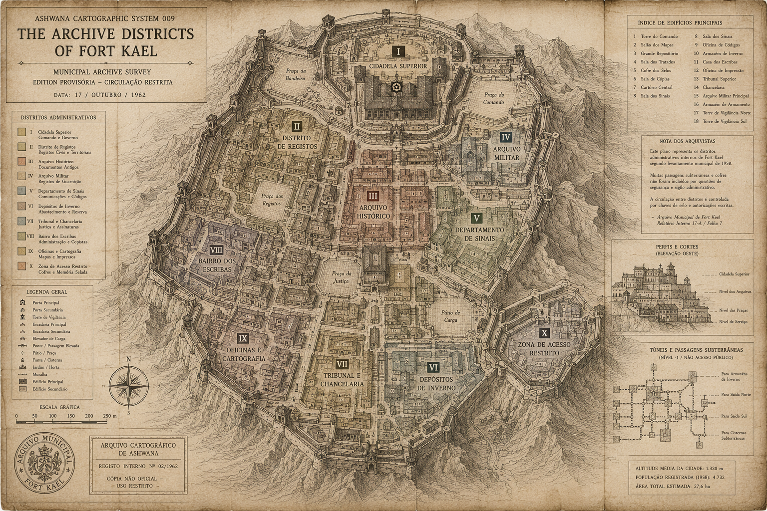
ASHWANA CARTOGRAPHIC SYSTEM 009 — THE ARCHIVE DISTRICTS OF FORT KAEL · MUNICIPAL ARCHIVE SURVEY · EDITION PROVISÓRIA — CIRCULAÇÃO RESTRITA
Cartographic note, appended: The Zone of Restricted Access — marked V on this map — contains the sealed room referenced in the Year 312 founding mandate. The room has not been opened in five hundred years. This map shows its location. It does not show what is inside it. That information is not available to the Cartographic Division.
The room has not been opened in five hundred years. Kira Ashvane works thirty metres from it every day.
READ ASHWANA — BOOK ONE →