
Eastern Ridge — Shepherd Routes and Seasonal Paths
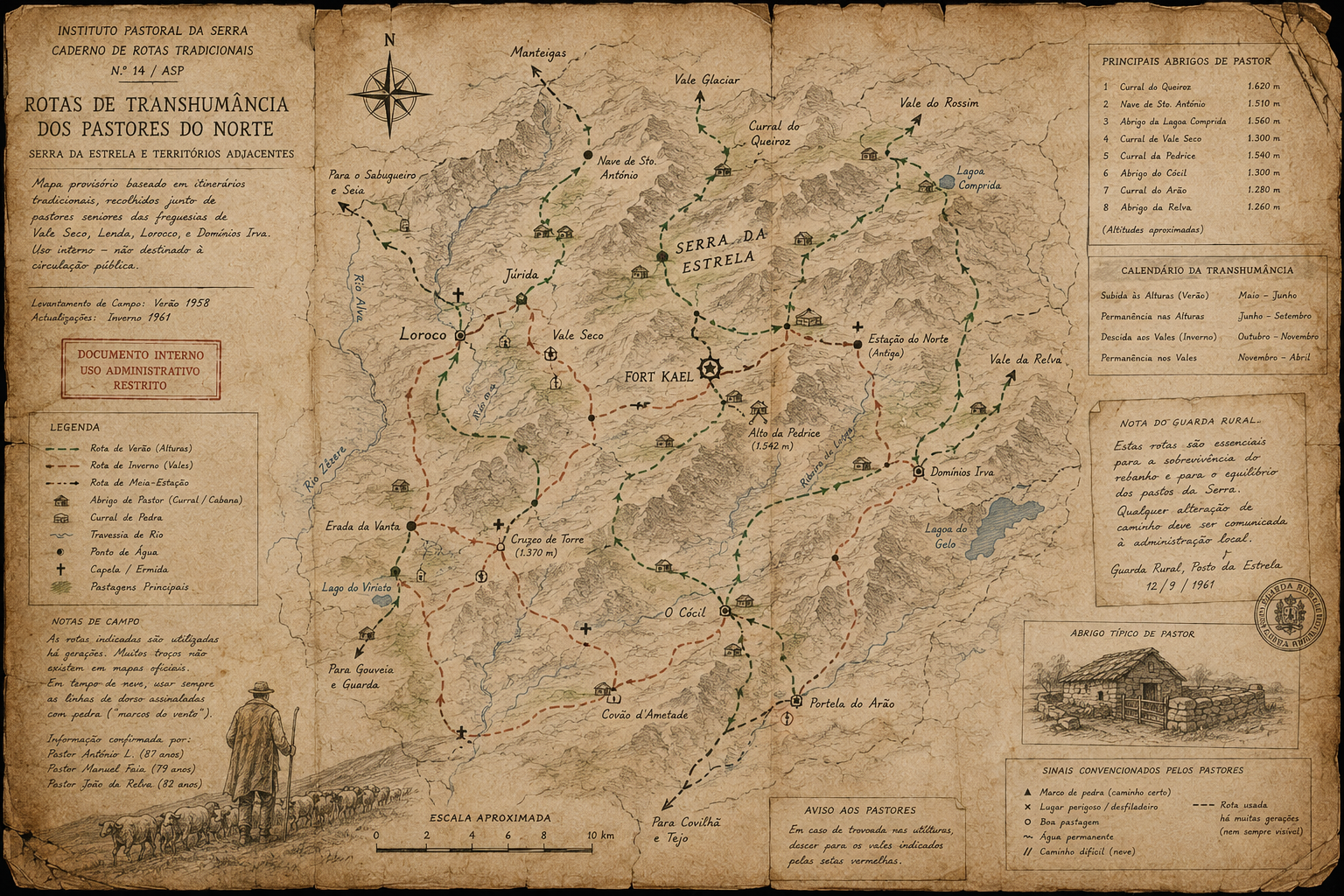
This map documents the transhumance routes of the northern shepherds — the seasonal paths used for the annual movement of flocks between the valley settlements and the high mountain pastures. The routes are shown for summer ascent and winter descent. Shelter locations, water sources, and seasonal crossing points are marked.
The map was produced in consultation with three shepherd communities of the eastern ridge. The communities cooperated with the survey. They provided information about the documented routes. They did not provide information about all routes. When asked about paths that survey officers had observed but that did not appear in the community survey data, the communities said those paths were not for the map. This response has been noted in every eastern ridge survey since Year 744.
The ground knows where it wants people to walk. The institution has not found a way to put that on a map.
READ ASHWANA — BOOK ONE →