The westernmost glaciated mountain range in the Iberian Peninsula.
Serra da Estrela is not simply the highest mountain in mainland Portugal. It is the westernmost glaciated range in the entire Iberian Central System — a distinction that places it in a specific geological category shared by no other Portuguese mountain. During the last glacial maximum, approximately thirty thousand years ago, an ice field developed on the plateau above 1,400 metres, covering an area of sixty-six square kilometres. The ice carved the landscape into the forms that remain today: the U-shaped valleys, the cirques, the moraine fields, the lakes that sit in glacially excavated basins.
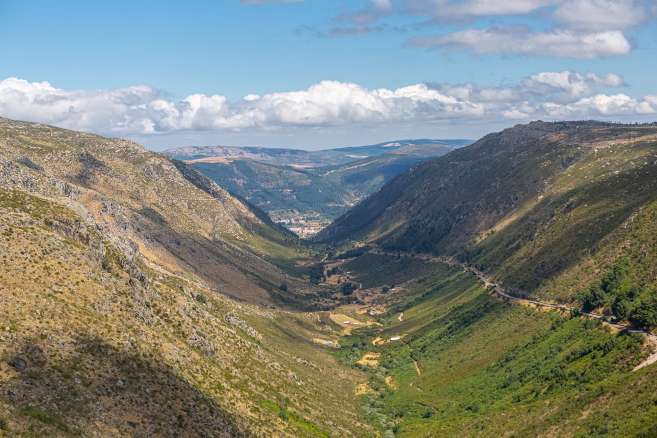
The Zêzere glacier was the largest of the radial valley glaciers that drained from the plateau ice field. It carved the valley now known as the Vale Glaciar do Zêzere — the longest glacial valley in the Iberian Peninsula — from the plateau down to approximately 750 metres near the village of Manteigas. The valley's U-shaped cross-section, its smooth granite walls, and the moraines deposited at its margins are direct physical evidence of the ice that shaped them. This is not a metaphor. The glacier was here. It left its work behind.
The granite of Serra da Estrela is between 280 and 340 million years old. The metamorphic rocks at the edges of the range — schists and greywackes — are older still, between 500 and 650 million years. The ice that carved the valleys thirty thousand years ago was working on material that had been in place for three hundred million years. The landscape is a record of time at a scale that resists ordinary comprehension.
Snow. Glacial valleys. The only ski resort in mainland Portugal. The source of three rivers.
Serra da Estrela is the only place in mainland Portugal where snow is guaranteed in winter. This alone separates it from every other Portuguese mountain range. The plateau above 1,500 metres receives more than 2,300 millimetres of rainfall annually — among the highest precipitation rates in the country — and at altitude this falls as snow. The snow is not occasional. It is structural. It shapes the hydrology, the vegetation, the routes, and the seasonal calendar of the region.
The mountain is the source of three rivers: the Zêzere, the Mondego, and the Alva. These rivers flow from the high plateau through the surrounding lowlands, carrying water from the mountain to the rest of central Portugal. The Mondego is the longest river with its source entirely within Portugal. It begins in Serra da Estrela and reaches the sea at Figueira da Foz, two hundred kilometres away. The mountain is not a watershed. It is the origin.
In 2020, Serra da Estrela was designated a UNESCO Global Geopark — a recognition of the exceptional geological diversity of the range, the clarity of its glacial landforms, and the significance of its rock record. The designation covers an area of 2,216 square kilometres across nine municipalities. It is the largest protected area in Portugal.
Human occupation since the fourth millennium BC. The mountain has been inhabited for six thousand years.
The UNESCO Geopark designation acknowledges not only the geological record of Serra da Estrela but its human record — an ancient human occupation dating to the beginning of the fourth millennium BC. The dolmens, the rock engravings, the Iron Age settlements, the Roman roads, the medieval villages, the shepherd routes — these are not separate from the landscape. They are part of it. Six thousand years of human activity have left their mark on the same granite that the ice left its mark on thirty thousand years before.
The transhumance routes that shepherds followed across the mountain for centuries align, in some cases, with paths that predate the current agricultural economy by millennia. The high plateau was used before the villages existed. The knowledge of how to move through it — when to go up, when to come down, which routes hold in winter, which water sources are reliable — accumulated across generations without being written down, because the people who held it had no reason to write it.
What makes Serra da Estrela different from other mountains is not any single quality. It is the accumulation: the altitude that produces snow, the ice that produced the valleys, the granite that produced the villages, the shepherds who produced the routes, the routes that produced the legends, the legends that produced the names. Each layer rests on the one before it. The mountain is a record of everything that happened on it, in an order that has not been fully read.
The world of ASHWANA is built on this specific mountain. Not a mountain like it. This one.
The world of ASHWANA uses the real geology, real hydrology, real settlement patterns, and real folklore of Serra da Estrela as its foundation. Fort Kael stands where the terrain demands a fortress — on high ground, controlling the routes between the plateau and the valleys below. The Ashwaste occupies the territory that the glacier once occupied, the high plateau where the ice field was, where the ordinary rules of terrain do not fully apply. The Ashlines follow the drainage patterns of a glaciated landscape — the valleys, the cirques, the routes that water has taken for thirty thousand years.
This is not fantasy geography. It is the real mountain, with the real mountain's history, carrying a story built on what that history actually contains: six thousand years of human occupation, thirty thousand years of glacial shaping, three hundred million years of granite. The world of ASHWANA did not invent a landscape. It inherited one.
ASHWANA — Book One of The Fractured Elden — is available now on Amazon, Apple Books, Kobo, and Google Play. The archive is not yet closed.